Welcome to Noise Map. Noise map is an interactive dashboard visualising the noise pollution generated from aircrafts and other transport means around the globe. We collect live aircraft locations and conduct noise simulations to estimate how much noise is being felt at different location near airports. We also conduct more fine-grained calculations to show how much noise is felt per hour, and how many planes fly on average in every location. Noise Map is developed and maintained by Nawar Halabi. To the Dashboard.
What We Do
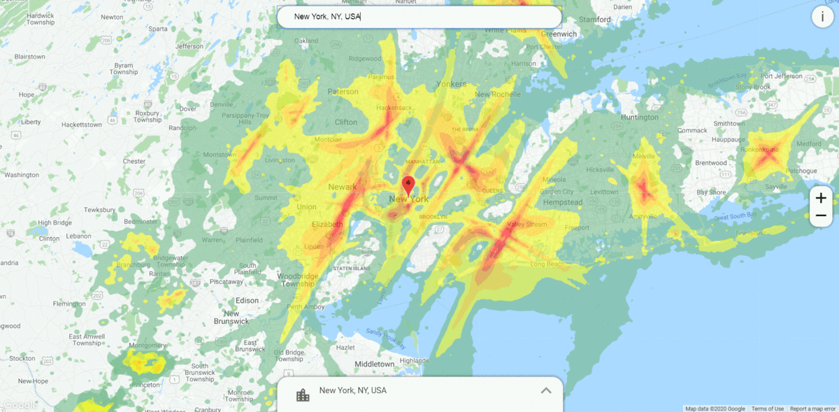
We visualise the noise as colored heatmaps where each color represents a decibel range. By clicking on the map, one is able to learn more about the noise level over time in a specific location. Try it yourself! Use the search too to find your location and see flight noise around you. Here are what the colors mean:
 | 50 db (quite rural background noise, library) |
 | 50-55 db (office average background noise) |
 | 55-60 db (conversational speech) |
 | 60-65 db (piano practice) |
 | 65-70 db (noisy restaurant) |
 | 70 > db (vacuum cleaner) |
Analytics
Using Big-Data analysis tools, we are able to recognise the changes in noise pollution overtime. This is most interesting in areas like New York City where noise pollution and flight noise are relatively high. This could be also interesting to city planning and managing aircraft routes to avoid harmful noise levels.
Why?
Noise has a large impact on houses’, apartments’ and other properties’ prices. Not to mention quality of life. Being able to transparently see where is louder and where is quieter, one could make better decisions on where to buy or rent. As we strive to reduce our CO2 emmissions, it is interesting to see the impact this has on the noise levels around the world.
How?
Noise Map uses modern big-data tools to anaylse and simulate noise around the world. We looked at noise propagation literature and understood how sounds travels. Using the available data (mainly ADS-B data) about plane locations around the world, we model and visualise the expected noise levels on the ground near airports around the world. We also visualise other types of noise on our dashboard (road, rail, …) based on the work of https://github.com/lukasmartinelli/osm-noise-pollution
We also work with GeoSci GmbH who intend to use the data as part of their toolkit of APIs to help home seekers get more info about the geographic location of their properties and more.
Contact
We are currently in the process of building a commercial API to expose noise-map data to other businesses.
Feel free to contact us with any questions and queries regarding using noise-map data in your app, API, data dumps or anything else through nawar.halabi@gmail.com